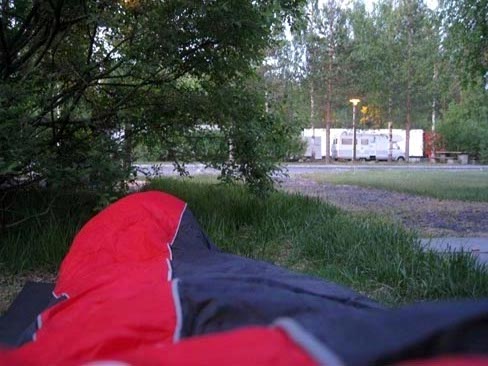
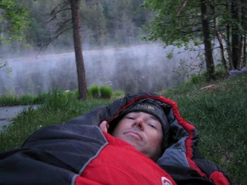
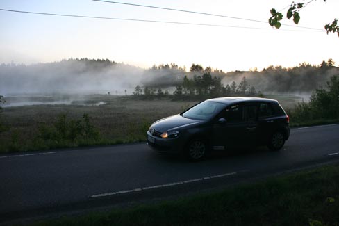
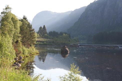
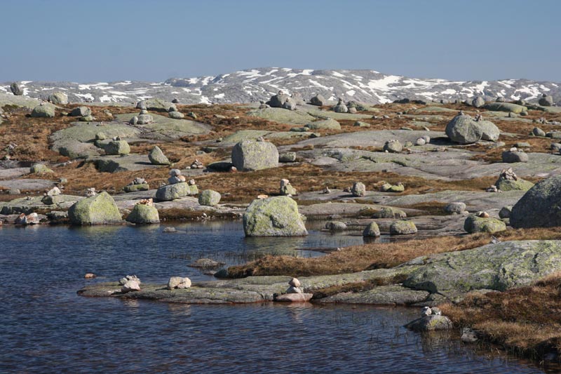
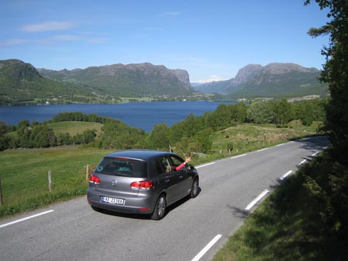
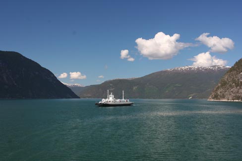
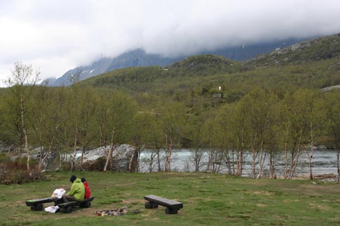
Good morning! Even though there`s nothing good about this morning. We arrived at Rygge with Ryanair yesterday at around ten in the evening and decided not to waste time in any hotel or campsite. It was nearly 600km to the first hiking trail. We managed to drive some 200km, including crossing the river with a ferry, until I fell asleep at the shore of this plashy lake. I couldn`t sleep for a long time anyway – it was light at three and we decided to go on.
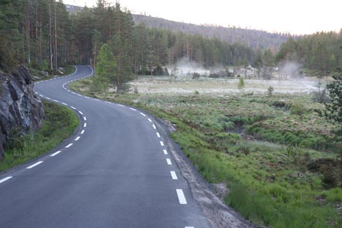
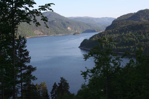

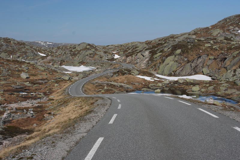
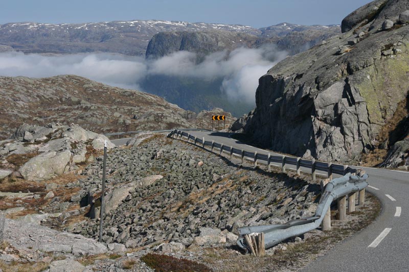
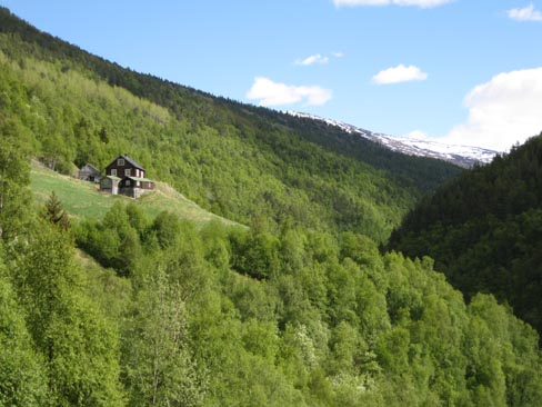
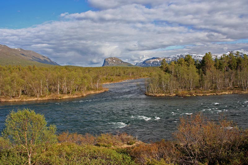
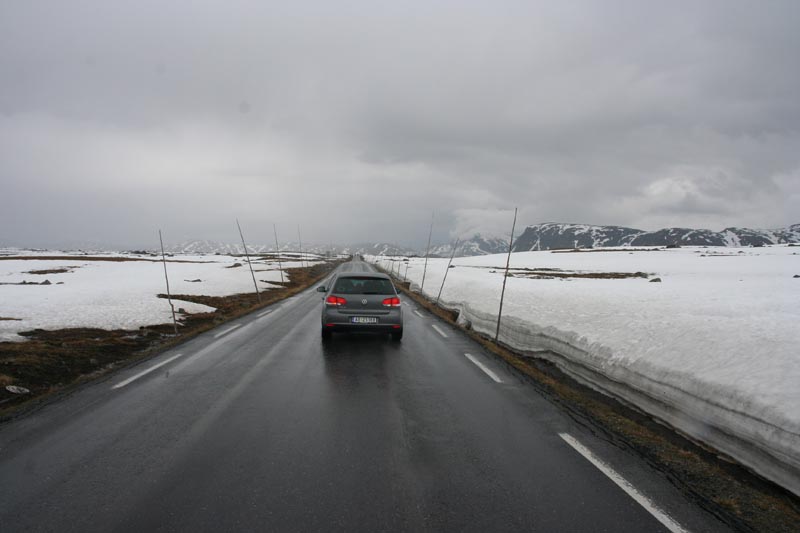
Around nine we had already crossed half of Norway, and our road led up to Lysebotn. For an hour we drove through a fantastic, lonesome plateau.

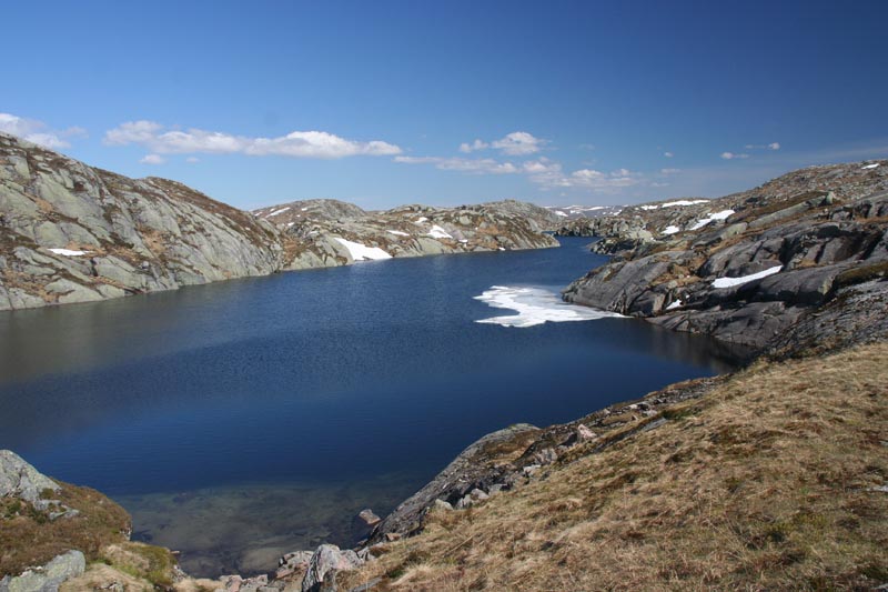
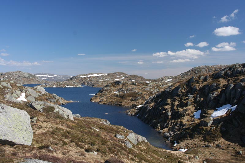
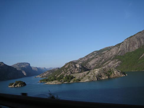
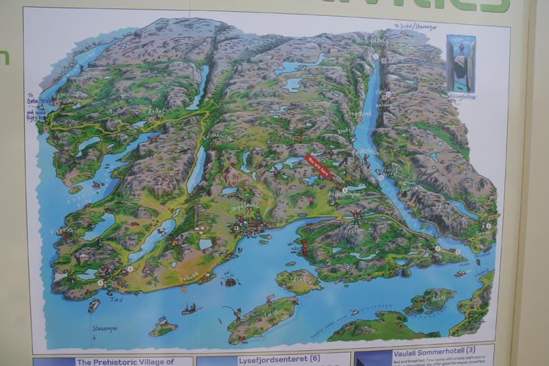
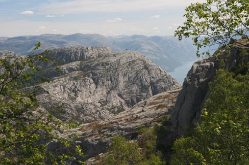
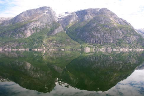
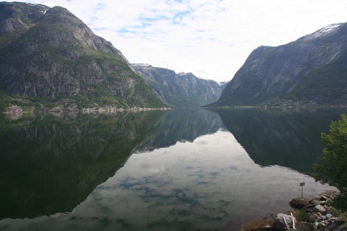
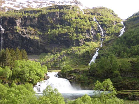
Beneath us we saw the morning mist flowing into Lysefjord.
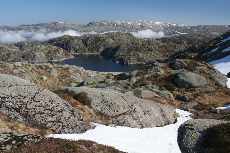
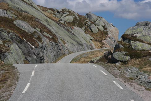
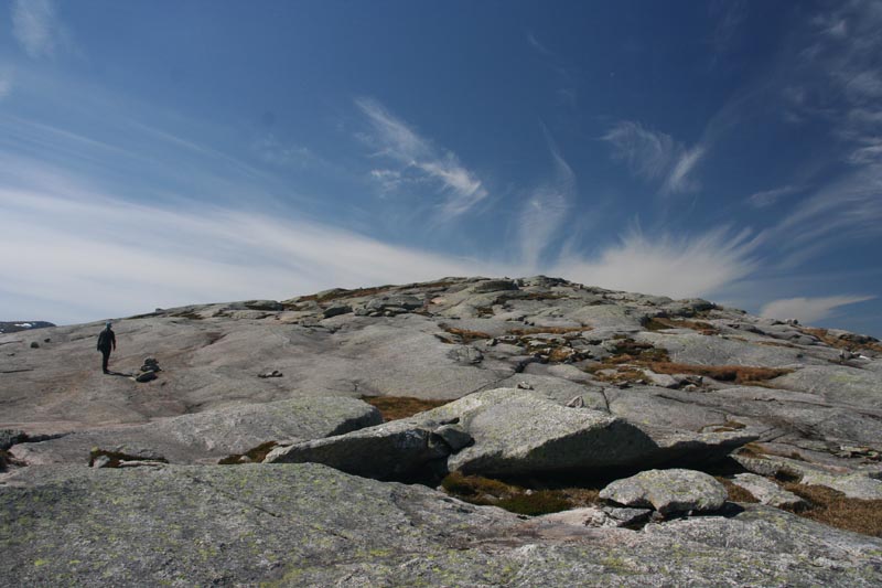
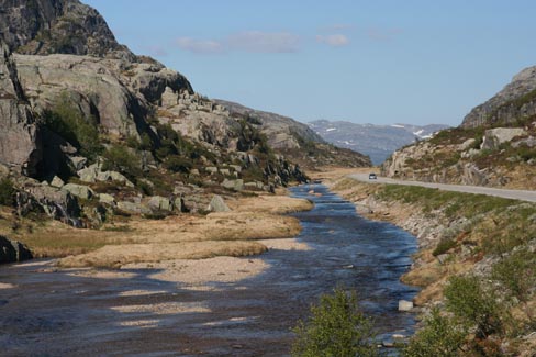
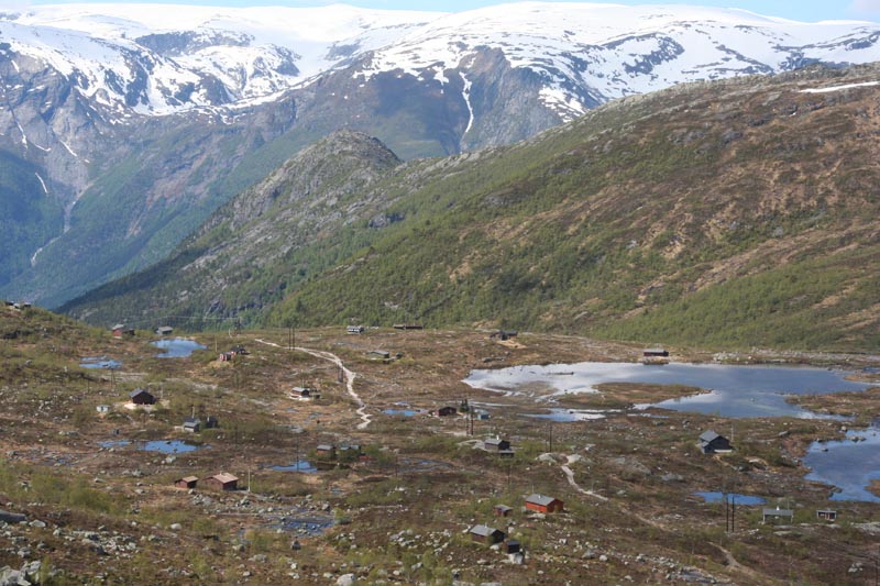
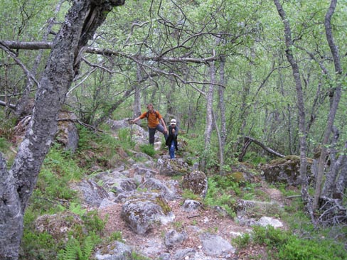
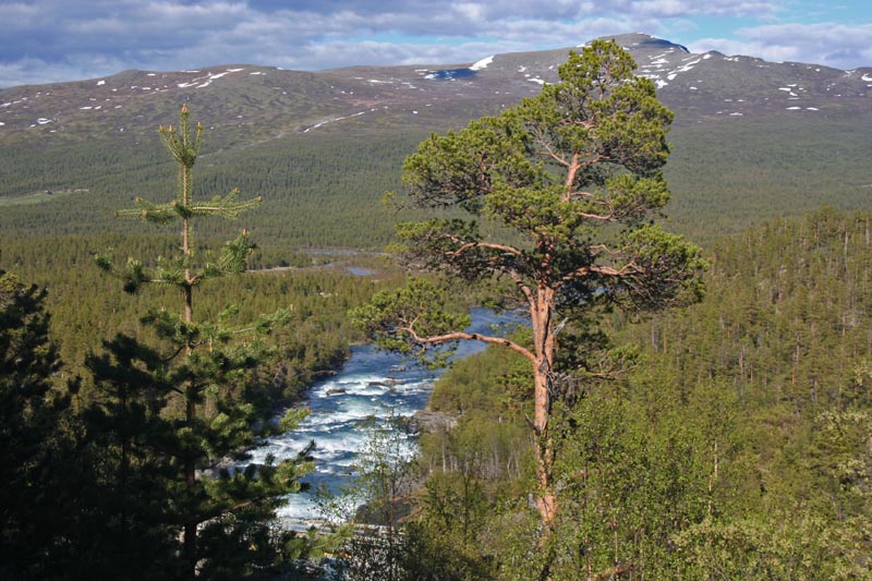
Here at 600 m a.s.l. started the trail.
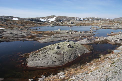
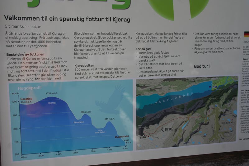
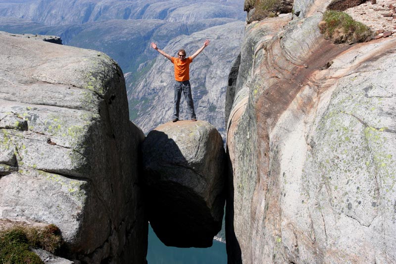
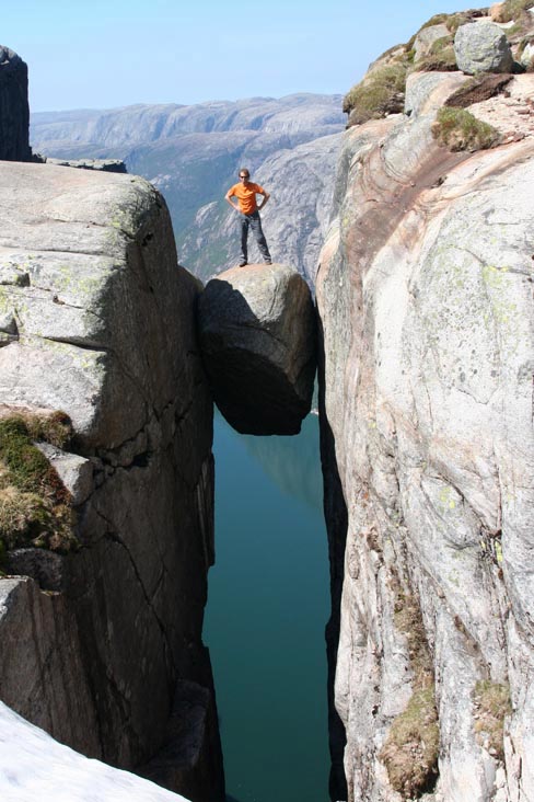
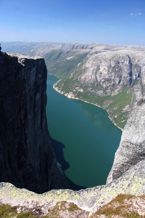
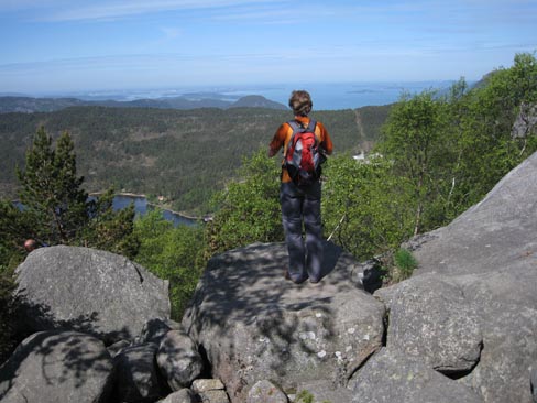
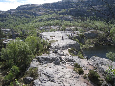
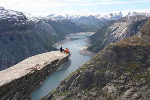
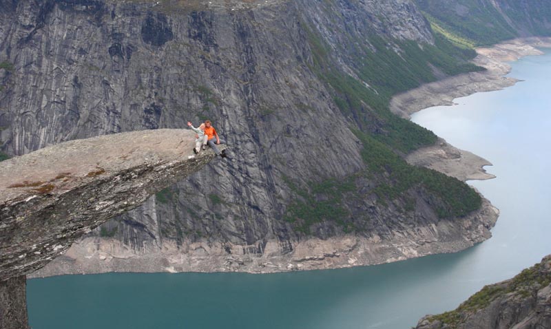
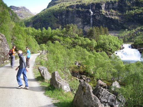
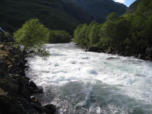
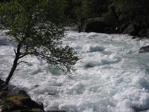
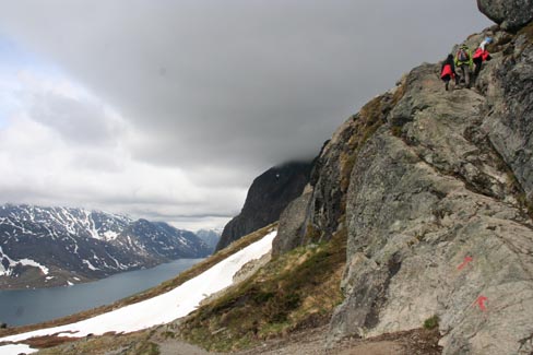
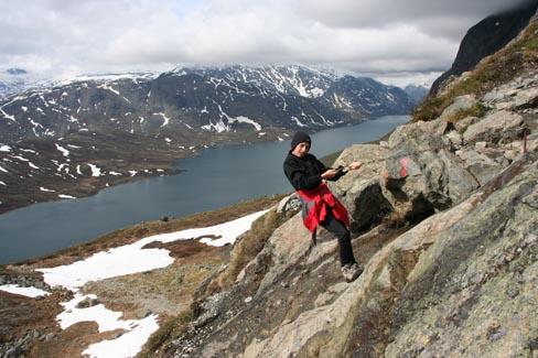
1. Kjerang trekking – to the boulder stuck in Lysefjord gorge.
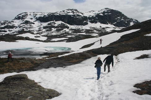
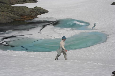
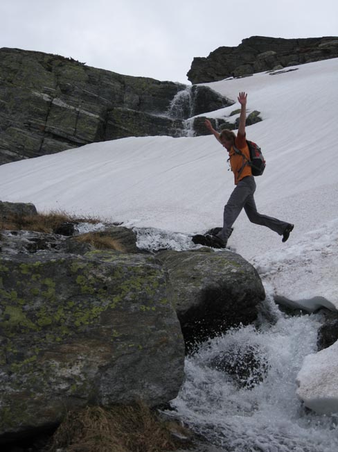
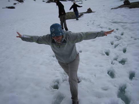
(12 km, 400 meters in height, 5 h) It didn`t go so well with the meters – after crossing several hills the total length of climbing came to a bit less than 700m. The rocks are very steep so better be wearing good Vibram soles. And don`t count on 5 hours because what you will see at the end … We needed 8 hours. Time to go! God tur! (a quote from the poster. I don`t know what that means:)
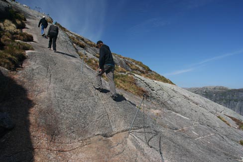
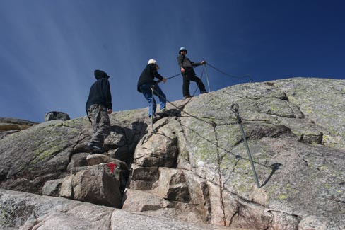
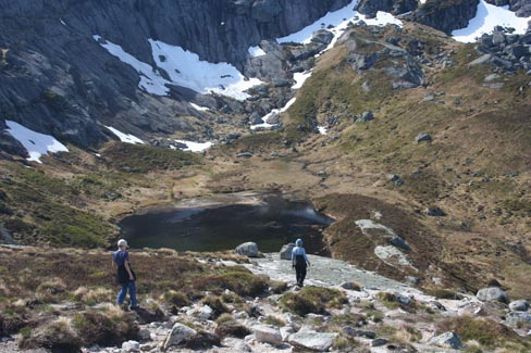
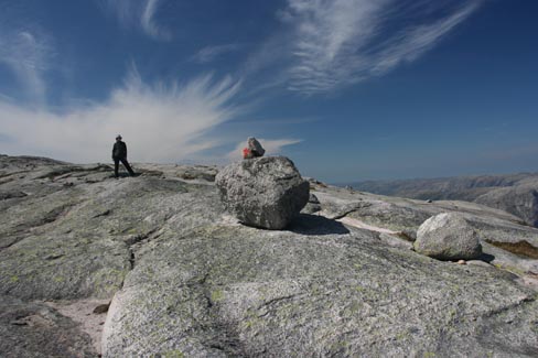
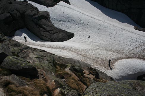
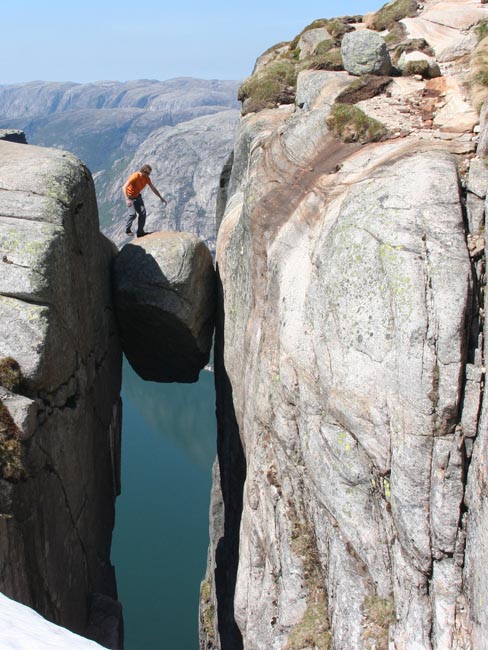
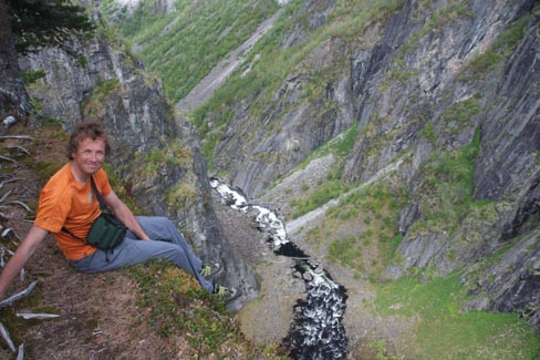
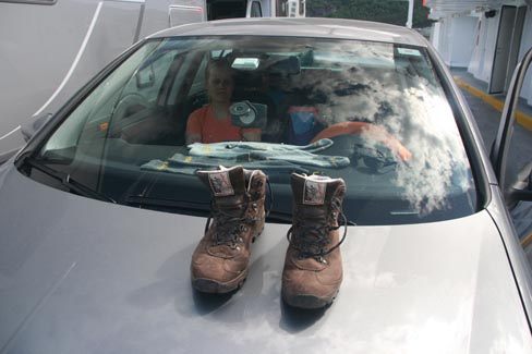
I will be lying if I say I jumped on the boulder without any problems. The wet soles from the snow and the dangerously round surface of the rock was not the friendliest combination. I wonder if any engineer has ever measured how tight is this peddle stuck between the walls of Lysefjord. I followed the principle that others do it as well and nothing has happened so far.
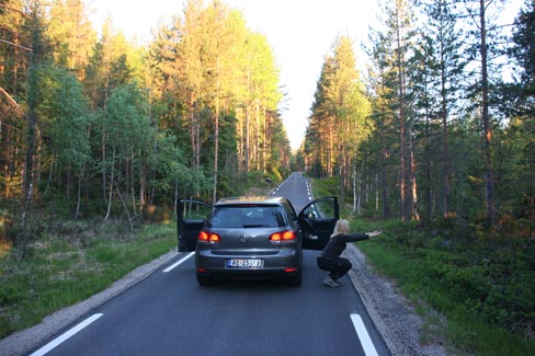
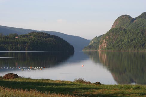
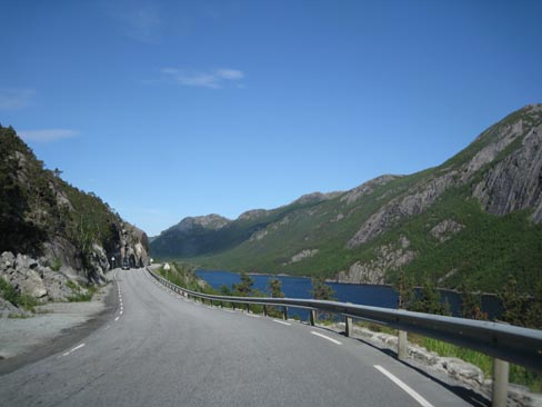
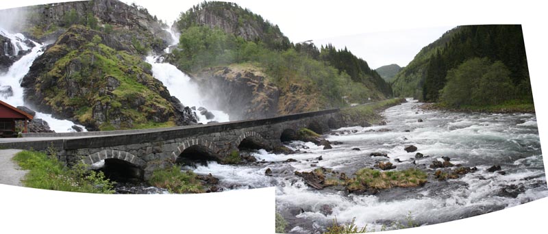
In the evening we took a toll road, which has been build in a deep gorge parallel to Lysefjord. As experienced tourists, we tried to ignore the signs that said – you have to pay for this road… until an automatic camera took a picture of us in the narrowest place of the road. Takk, you will receive the bill by post!
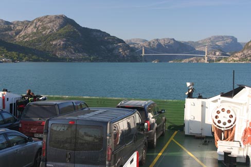
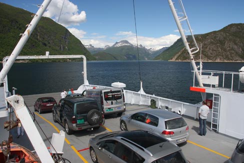
Then again we went by ferry. Ferry traffic here is so regular that no timetables exist. You are driving and uncle TomTom notifies you: “Continue by ferry”. The road ends and all the cars slide on the nearest ferry. Nobody even asks where it goes.
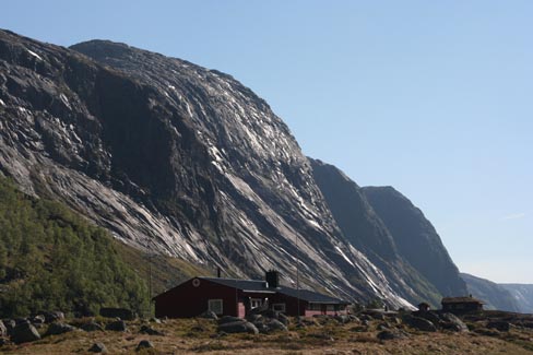
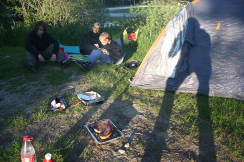
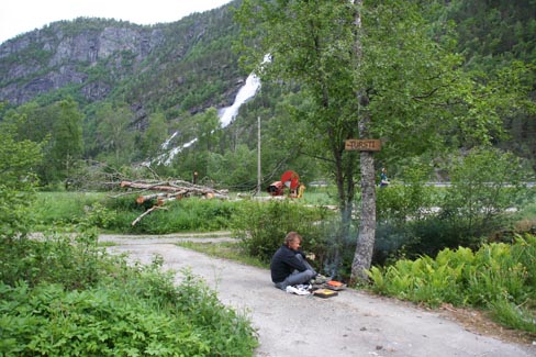
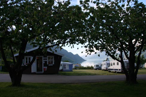
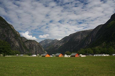
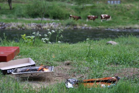
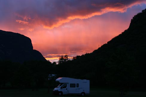
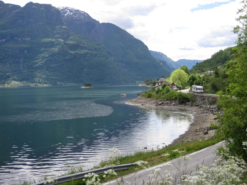
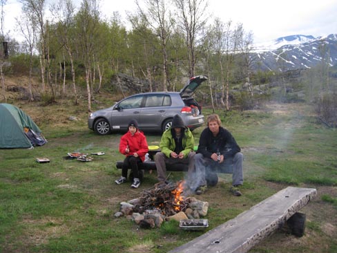
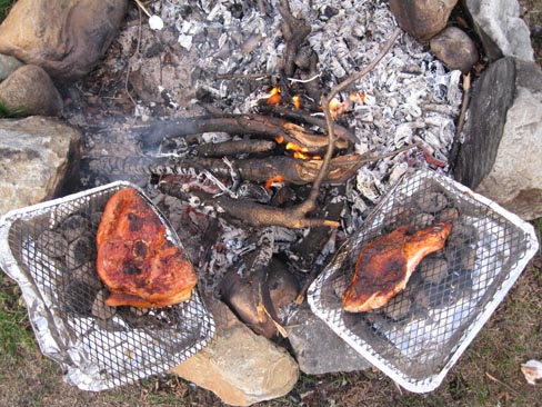
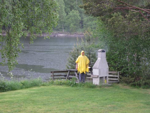
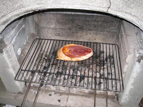
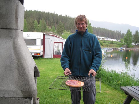
Roadside taverns` prices were monstrous, even brutal. One schnitzel or entrecote costed around 30 EUR. A family`s dinner with a second meal and a glass of juice for us would cost around 120 EUR. In a hurry we ran into the first shop – I don`t recall if it was COOP, Rimi or Rema 1000. Anyway Flinstones` steak here costed 5 EUR a kilo, which you have to cook yourself. We stayed at a campsite on the other side of Lysebotn and soon we made the entire area smell like tasty barbecue. We grilled the meat and prepared for tomorrow’s hike.
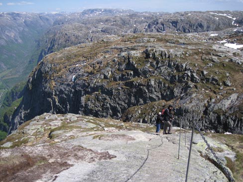
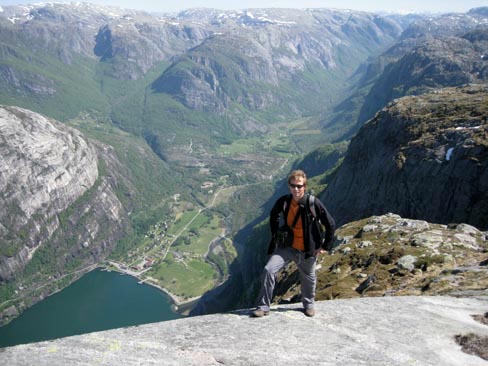
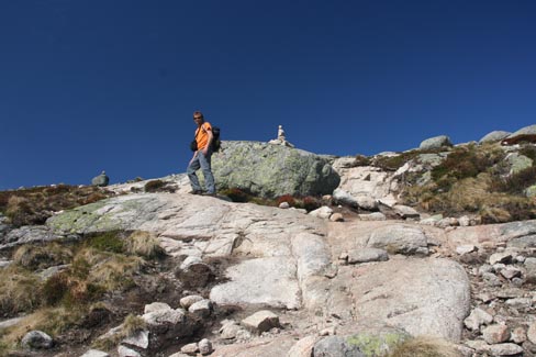
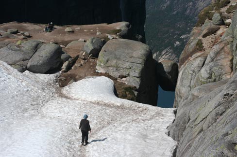
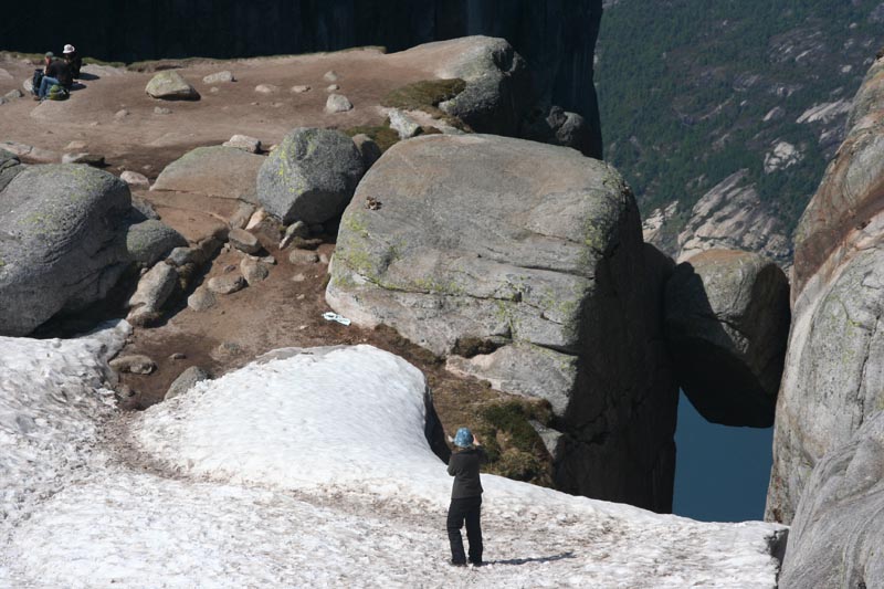
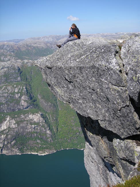
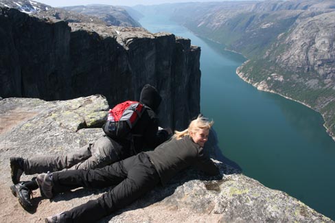
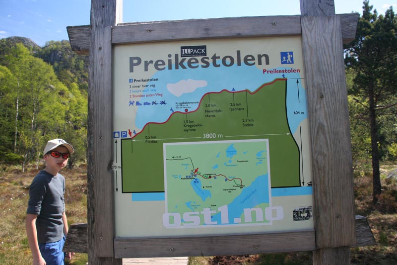
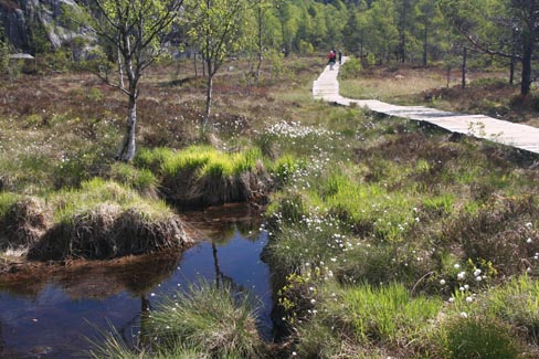
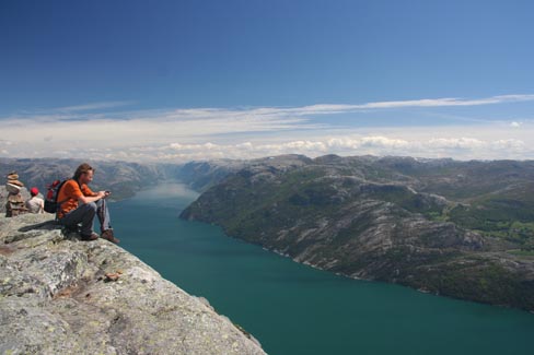
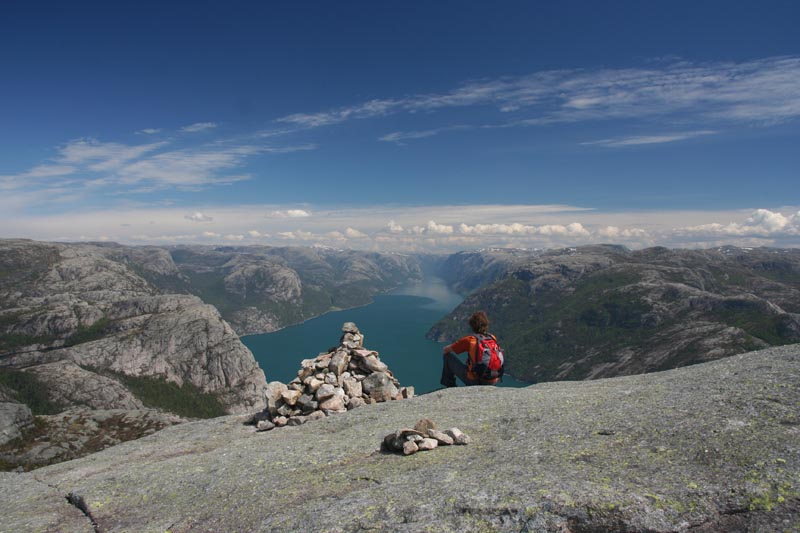
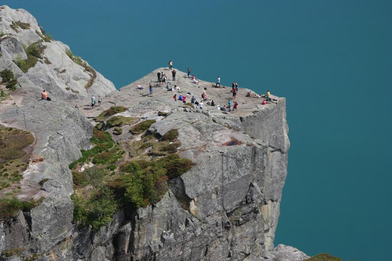
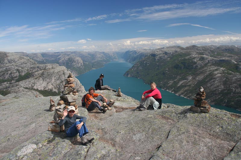
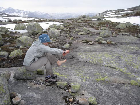
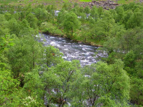
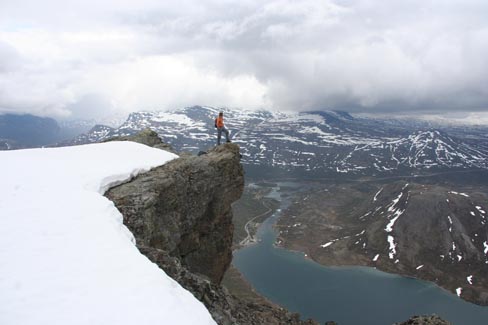
2. Preikestolen trekkings – to Lysefjord`s Pulpit rock (8km, 400m in height, 5-6h).
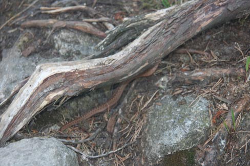
When the trail had led us up the hill on stone plates polished by tourists, we suddenly ended up in a swamp. I almost tripped on a snake (see below). A German tourist asked me what type of snake it was. I said that I don`t know the name but people usually die. The German guy became thoughtful – had he chosen the right country to visit during his vacation.
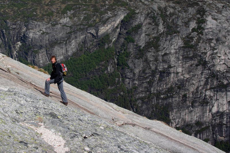
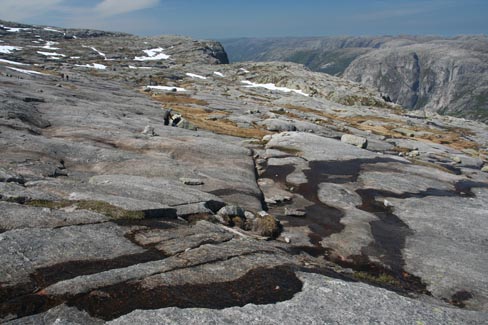
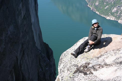
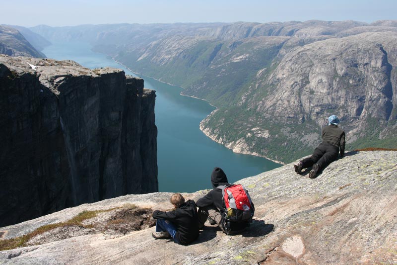
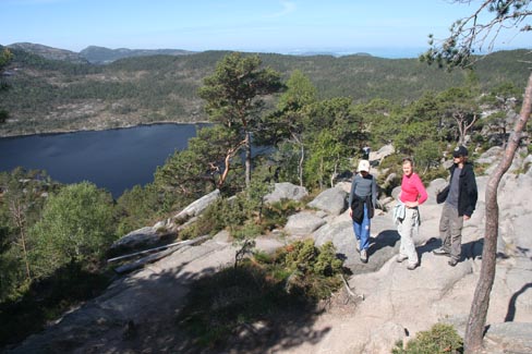
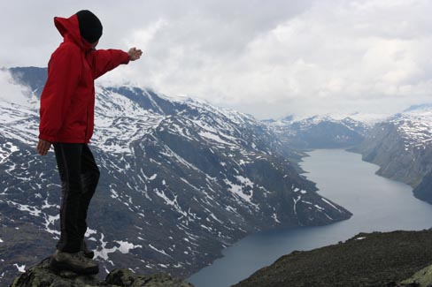
After a steep climb we reached a passage from which we could see the side of our friend Lysefjord. Now we only had to walk round the mountain where the probably most famous rock of Norway was standing.
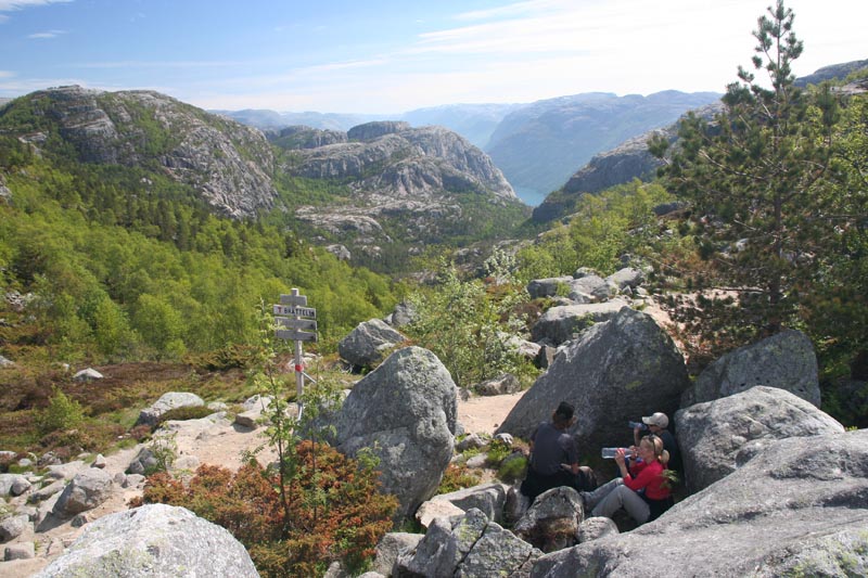
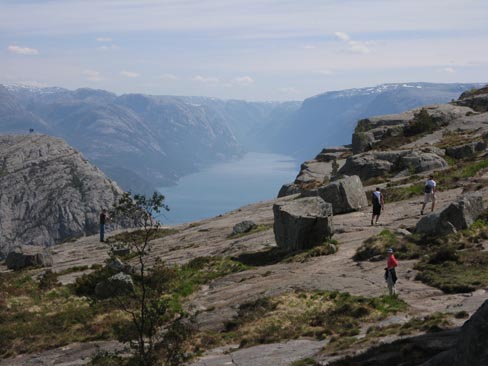
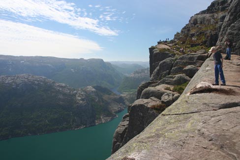
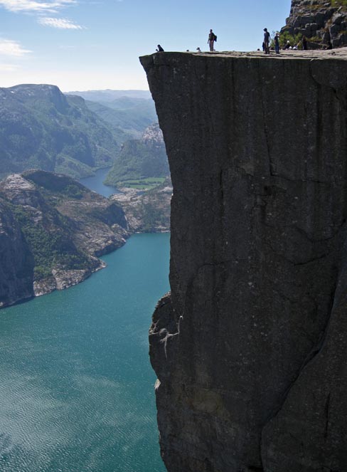
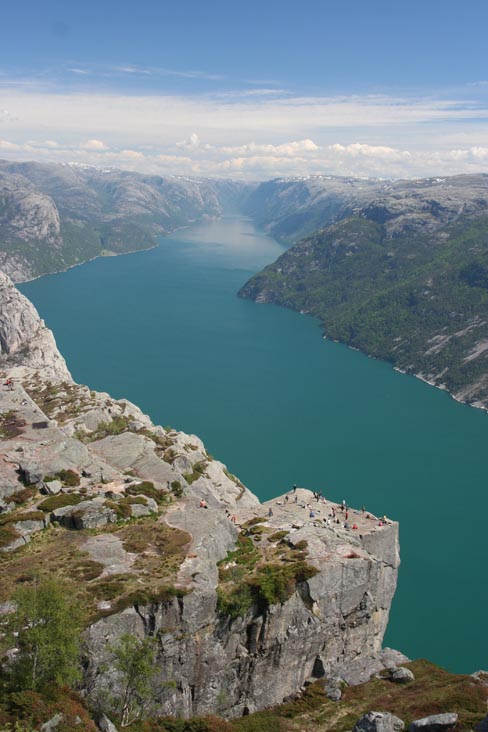
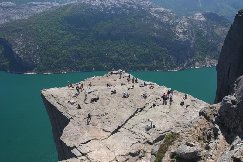
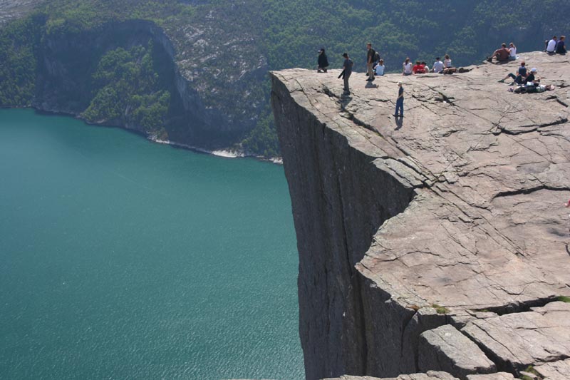
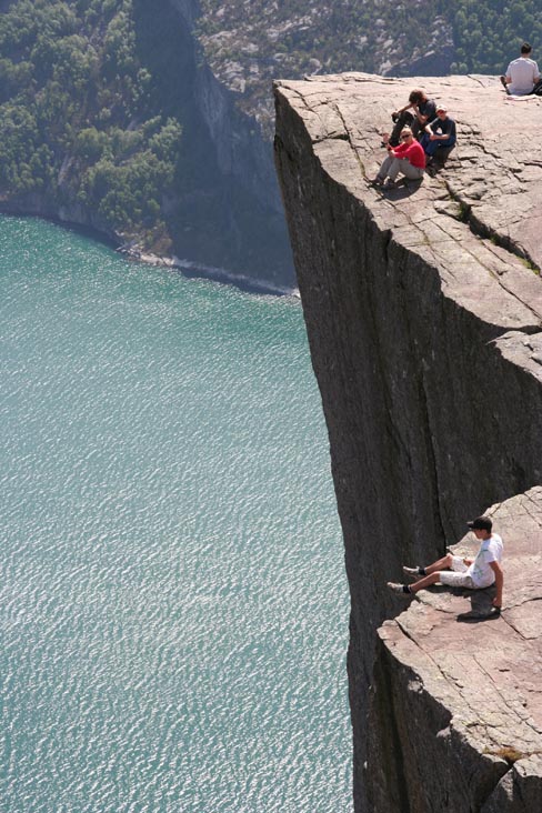
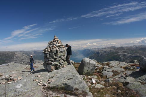
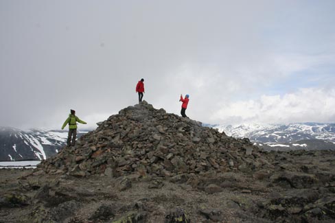
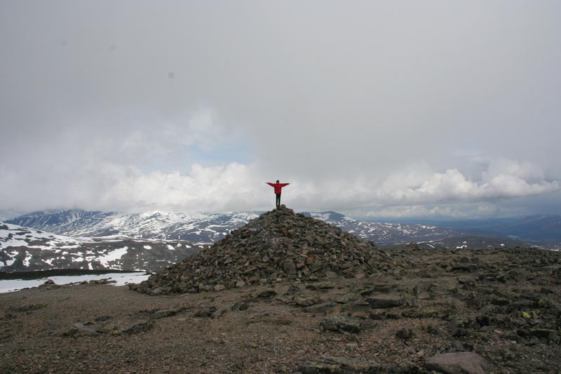
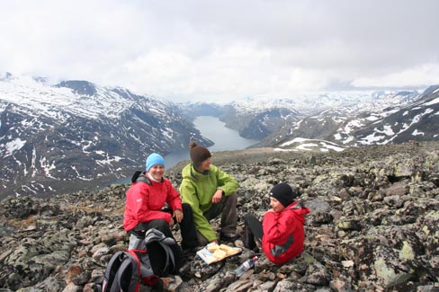
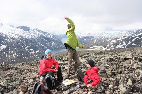
For one geocache and a better view we climbed up some more – to the very top. Fantastic!
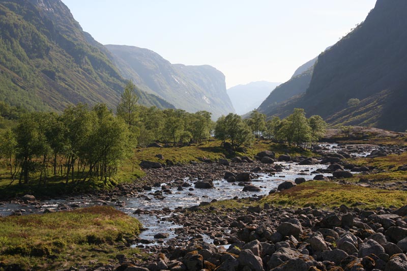
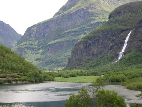
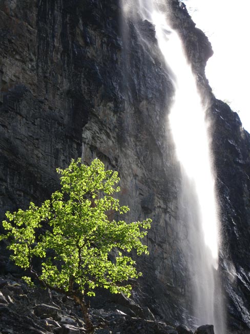
In the evening we continued the good old tradition – drive until the nightfall. Darkness came by a large waterfall, where we cooked the Flinstones` meat again.
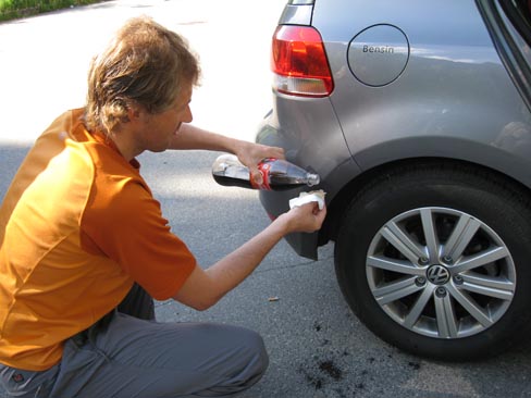
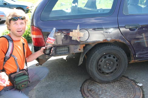
We faced some insignificant scrape at the campsite – the car touched one of those weird electric boxes they have build in the very middle of the meadow. Who would have thought that there is a pillar in the middle of the meadow! Nothing bad happened – a bit of a different colour on the bumper. Then we remembered an article about the wicked impact of coke on a growing organism. What if we could restrain this force and make it work for us – to dissolve the strange colour? And, see, at the morning it had been dissolved completely!
🙂
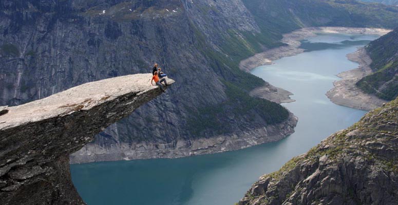
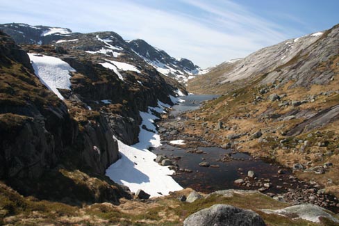
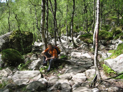
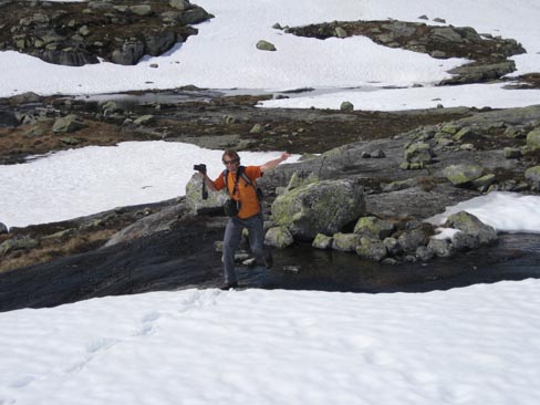
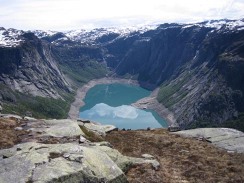
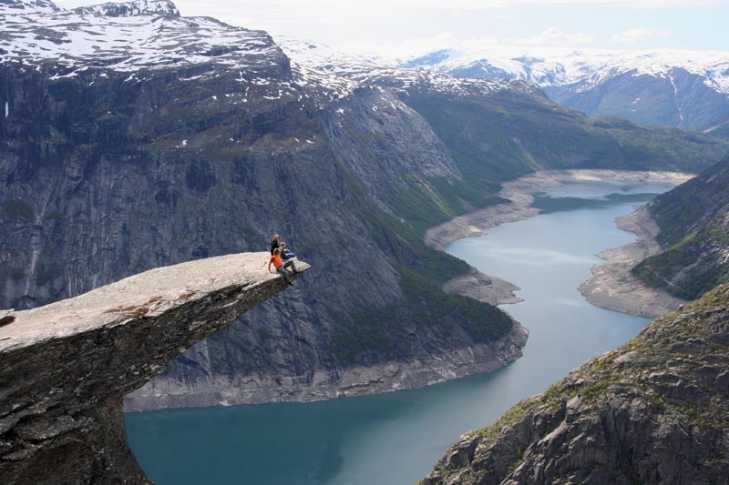
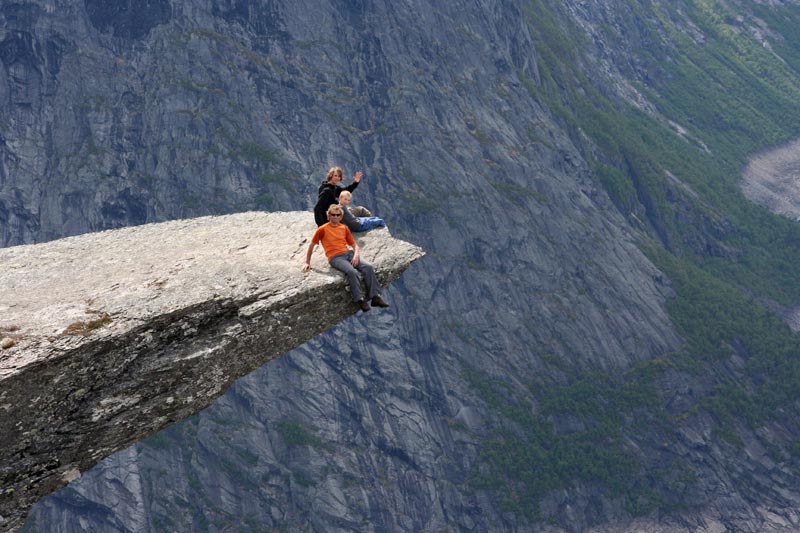
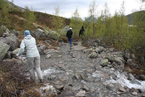
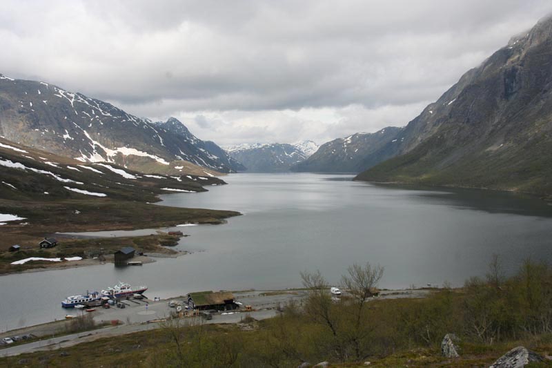
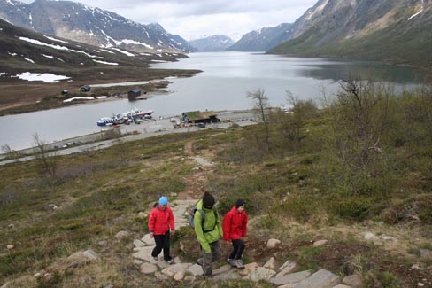
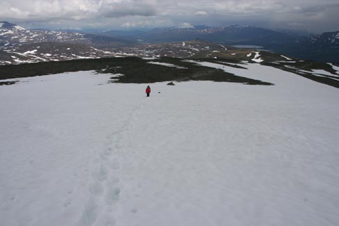
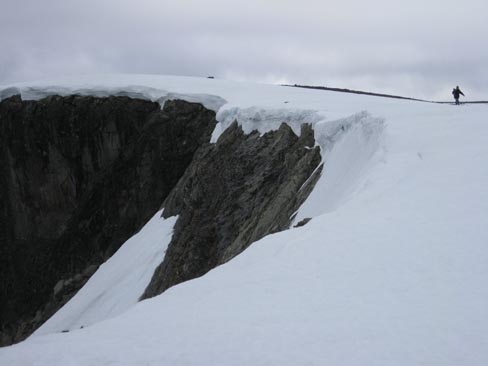
3. Trolltunga trekkings – to Troll`s Tongue (20km, 600m in height, 10h).
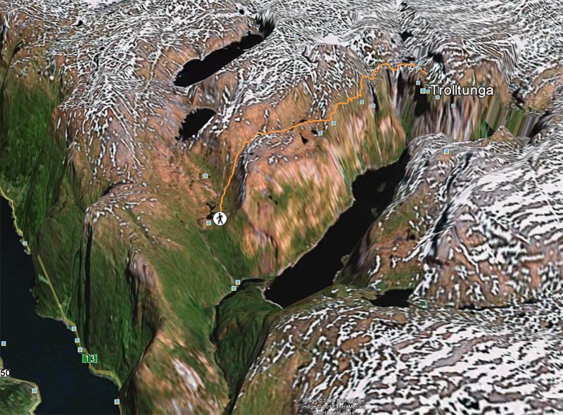
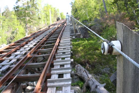
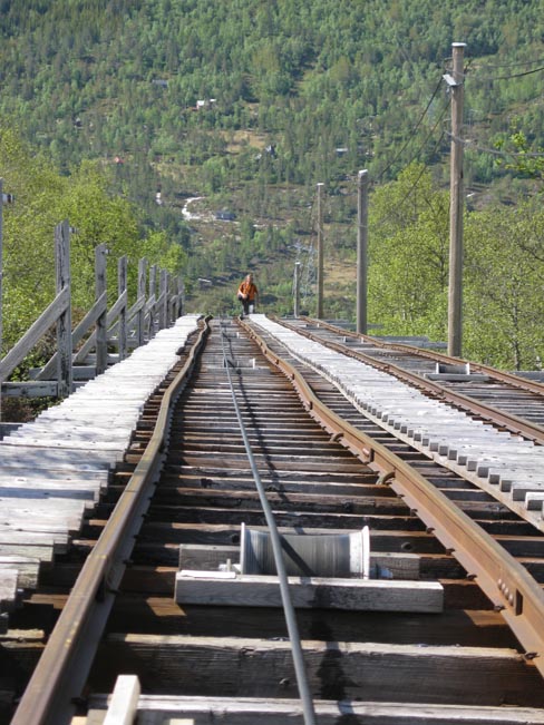
To get to the first rock we had to meander on a path. Here our sight was caught by an interesting construction – a straight line of abandoned wagon tracks went up in the sky. We checked the gate – it was not locked. We began to climb. At first they were flat but then somewhere in the middle the tracks became very steep. It was too late to come down from the scaffolding. We didn`t want to hold on to the railing because for some reason it was separated from the ground by insulators. So we spent an hour on this giant stepper.
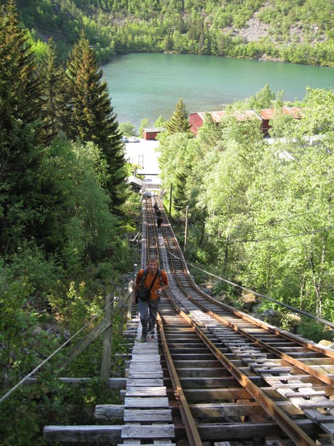
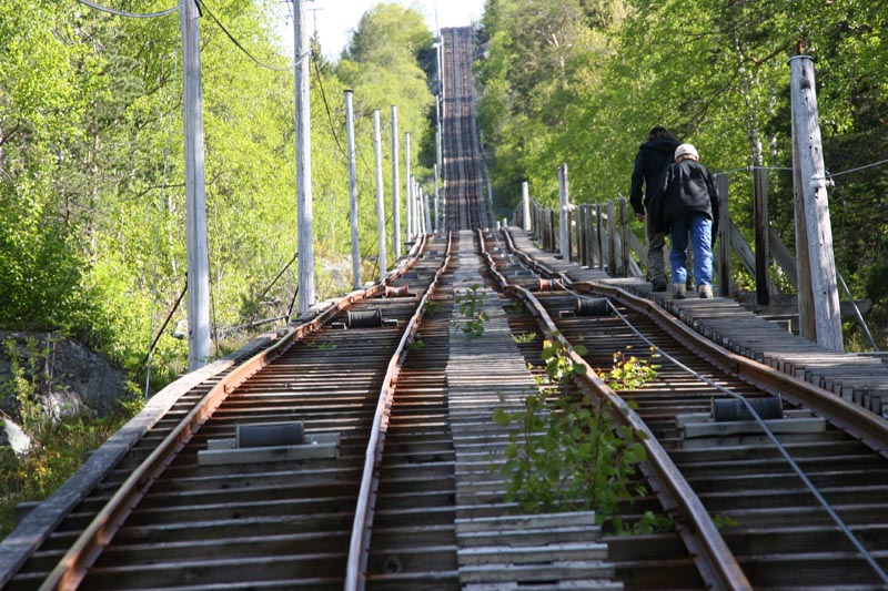
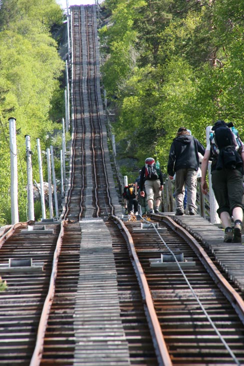
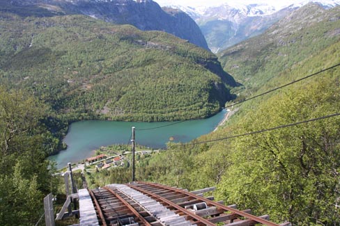
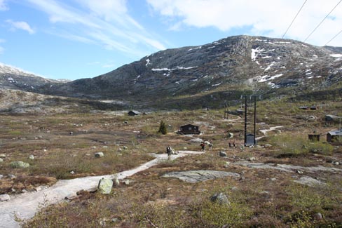
At the end of the tracks we saw a surreal view – a lonely plateau with a dozen of apparently deserted houses. Did people leave only for the winter? Will the wagons be towed again in July – the only vehicle that connects this town with the outside world? We didn`t have time to solve this puzzle because our GPS showed at least 3,5 hours to the Troll`s Tongue.
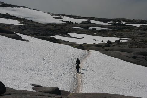
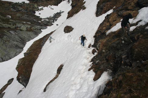
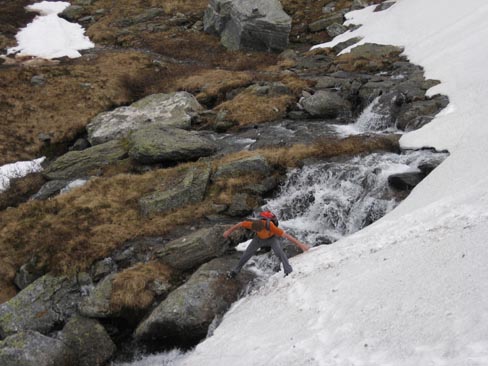
At the first passage we realized why the tourist season here is opened only in July. It was still winter here in the middle of June.
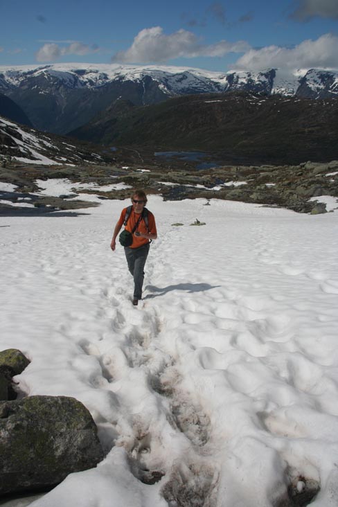
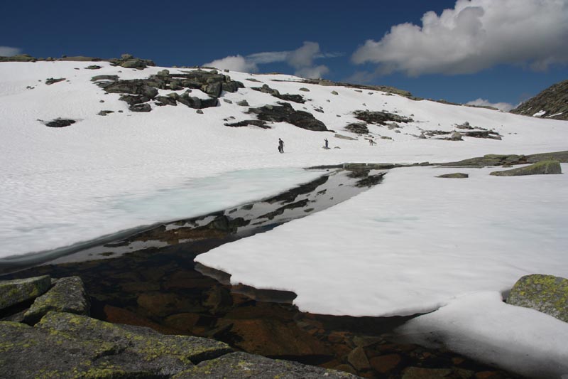
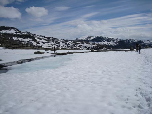
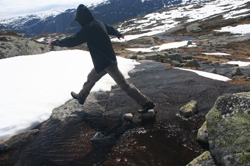
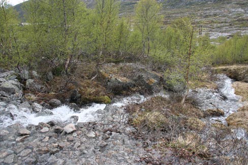
Oh, no! The winter here was not as deep as one could wish. In the warm sun the snow was melting and under the layer of snow meltwater was flowing. From time to time one of us broke through and had their boot filled with water.
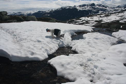
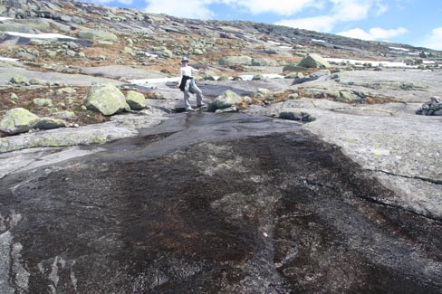
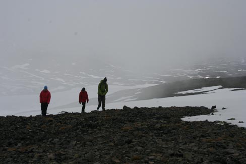
In the last hour we traversed through a steep canyon full of snow and then we manoeuvred through moraine fields. The signs of the trail were snowbounded so after each crossing of a snowy spot we had to look for the end of the trail, which often turned out to be in a different direction. Paddling about this small trail, our feet were completely soaked but we didn`t even think about giving up – the goal was so close!

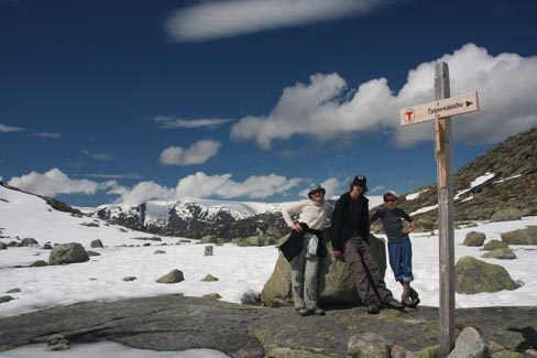
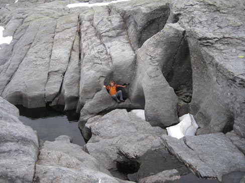
Ups! The troll has one giant tongue. It was worth it.
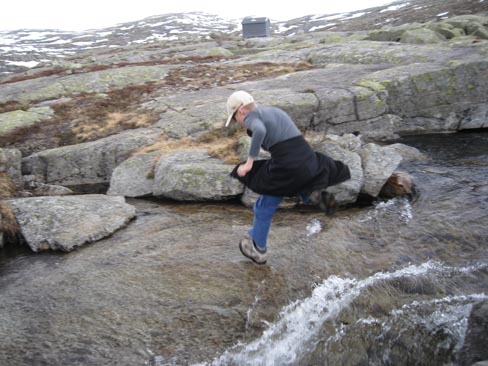
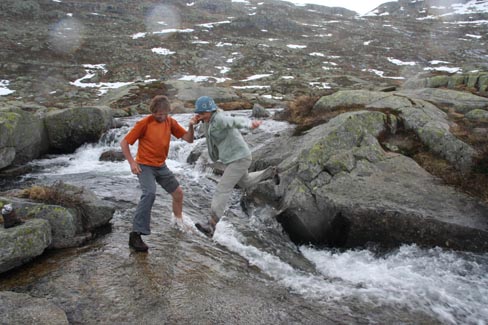
On the way back we found stone baths but it began to rain. The rivers of the melting snow had become twice as fierce. In places, which we crossed without any problems before, we had to be very careful not to be dragged under the ice.
The path above the abandoned village had turned into a river.
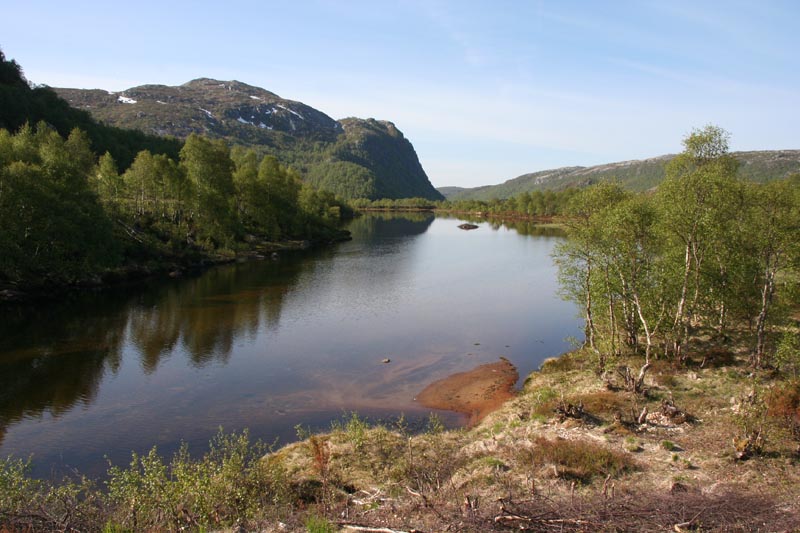
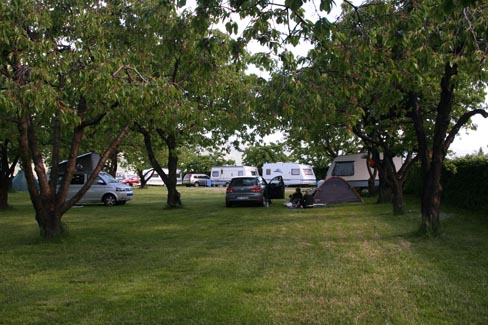
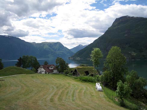
While we were on the tracks again, the weather cleared up again. We found a camping place in an old cherry garden. Apple and cherry trees are this fjord`s speciality.
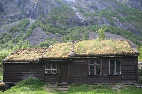
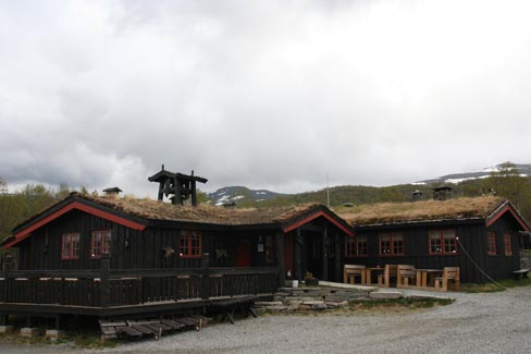
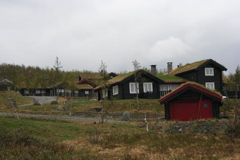
The Norwegians are like trolls living in small moss houses. It rains here so regularly that the turf on the roof is swollen all year long. It probably leaks through if it dries.
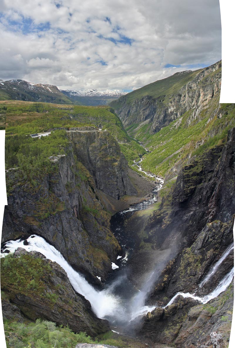
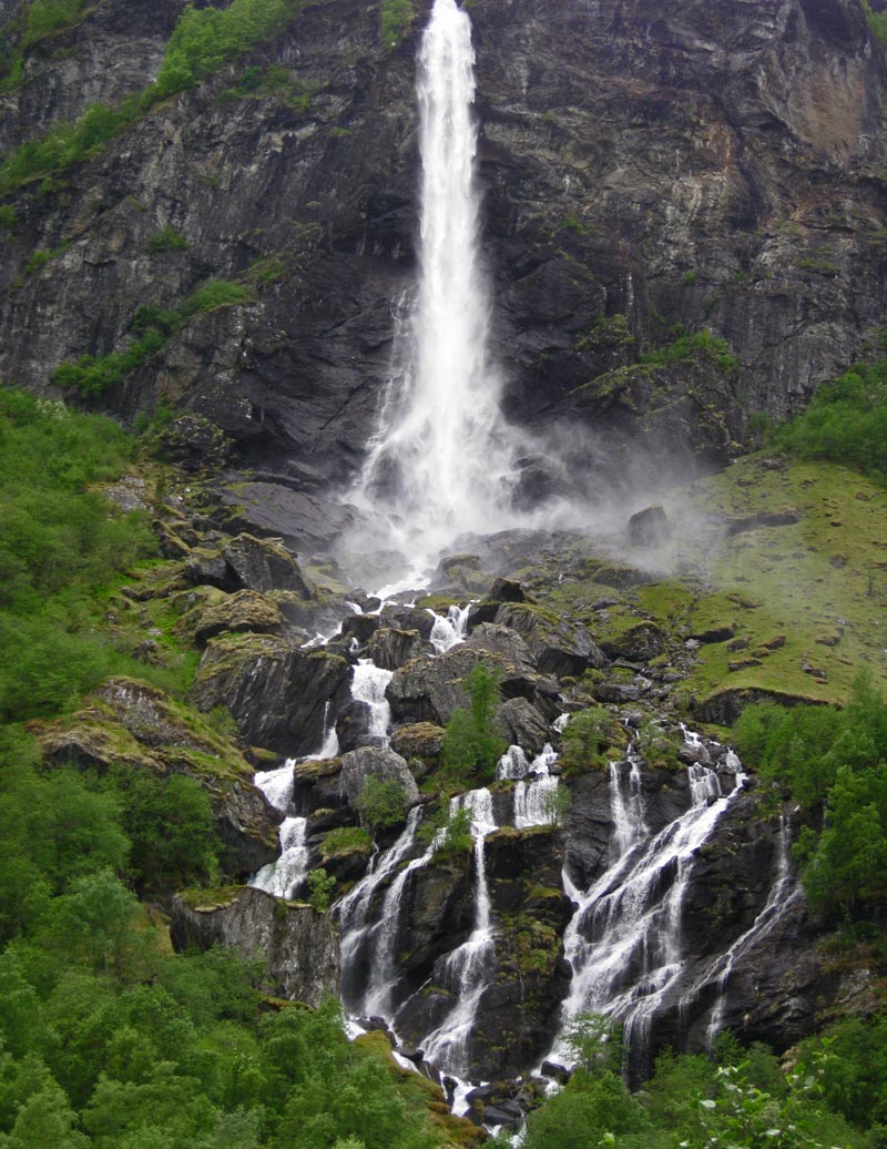
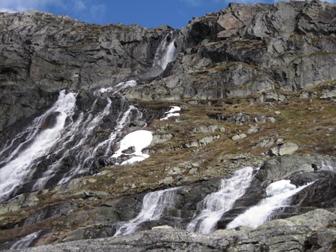
The next day we drove pass Voringsfossen waterfall. Impressive, but perhaps too civilized. At other sites trolls were not sold.
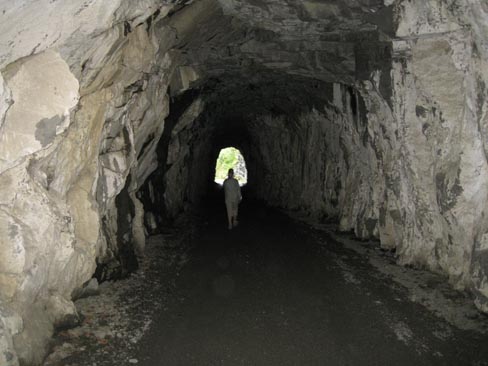
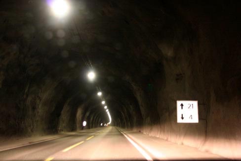
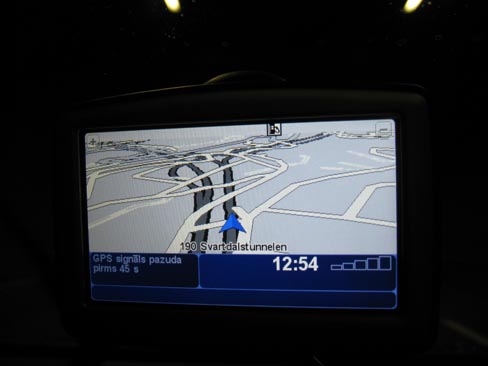
Then we drove around the underground a bit (uncle TomTom showed us that we crossed the very same place one minute ago but only on a different level).
Then, according to his thoughts, we had to take the ferry again.
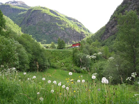
Eventually, late in the afternoon we approached our fourth route. It began at the very middle of the famous mountain railway line Flamsdalen.
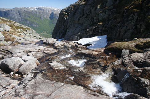
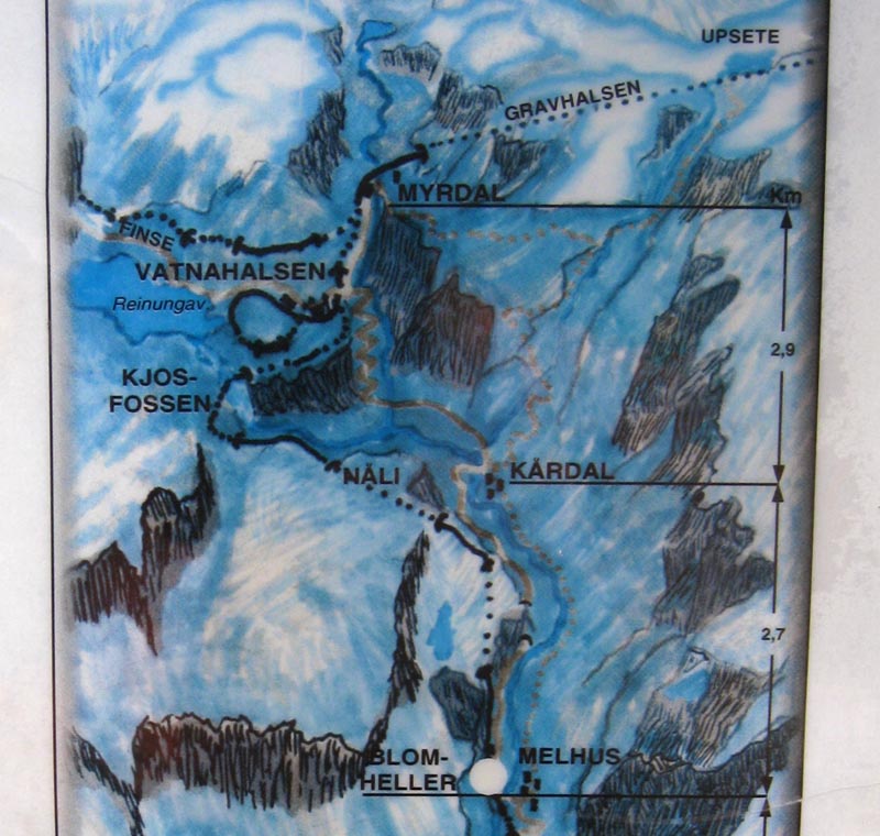
4. By Flam railway to Kjosfossen waterfall
(40km by bike/ 10km by car + on foot / 0 km by train 🙂
We didn`t want to take the train and it was also quite late to manage to travel the entire route back and forth. Fortunately we found a small mountain road parallel to the tracks – at times it was closed by gates, at times it crossed the railway but it shortened our walking distance for 15km. This road was actively used by velotourists.
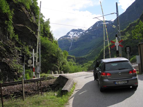
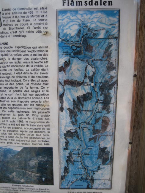
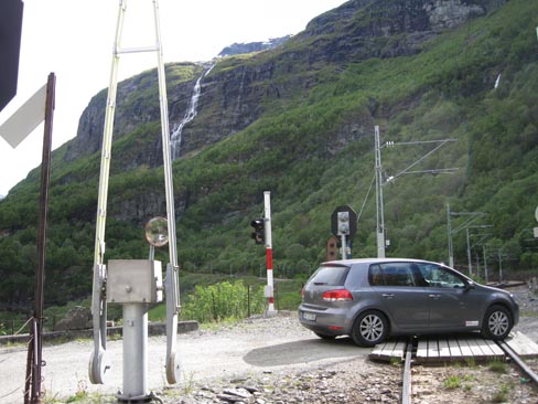
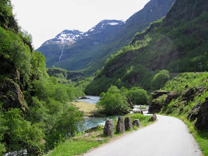
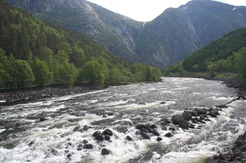
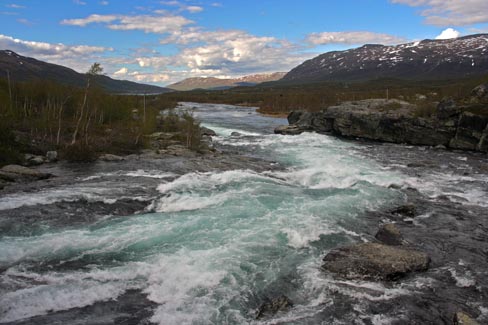
The road ended in Blomheller. We could have driven further but we respect the sign which allowed continuing for cyclists and trekkers – just like us. After Kardal the road continued on a hill but we needed to get into the valley on the left. We didn`t get to the main waterfall because we couldn`t find any useful trail – a huge rockfall ended at the canyon. We had to take the railroad tracks in Kardal and then follow them. Or even go by train. Next time we will know. But the view in the valley was fantastic and the river – amazing!
We enjoyed the sight of our next accommodation in the evening sun. We cooked the Flinstones` meat and watched the Arctic lights.
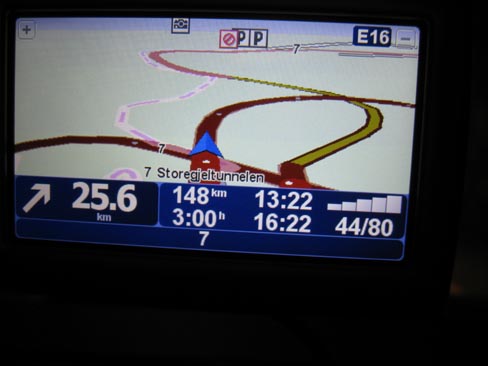
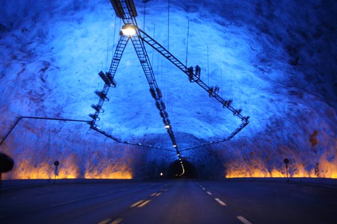
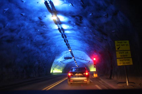
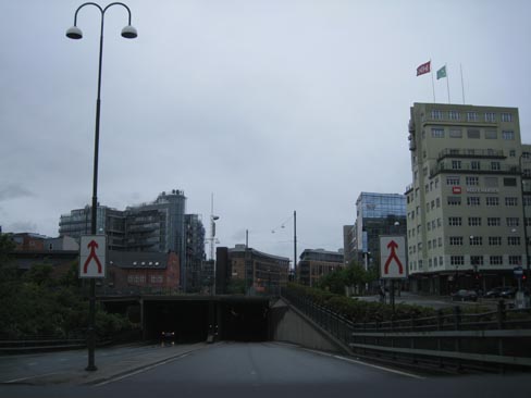
In the morning we wanted to enjoy the fjords sparkling in the sun but the road suddenly disappeared in the underground for … 25 km (this turned out to be the longest tunnel in Norway!). So that the drivers would not become depressed, smart Norwegians had built some type of relaxation places every 5km. . . Unfortunately, the effect of the first relaxation place quickly disappeared when suddenly traffic lights appeared with a sign on them – waiting time from 0 – 30 min. Eventually we got out of this tube only after an hour.
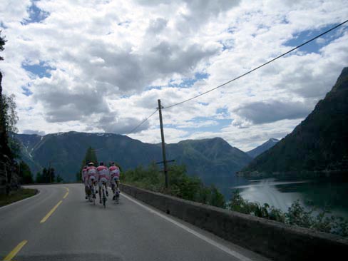
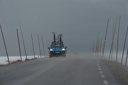
Many kilometres we had to lag behind a bunch of cyclists who here are very shameless cycling in the middle of the road next to each other. Later it turned out that it was our country national team:)
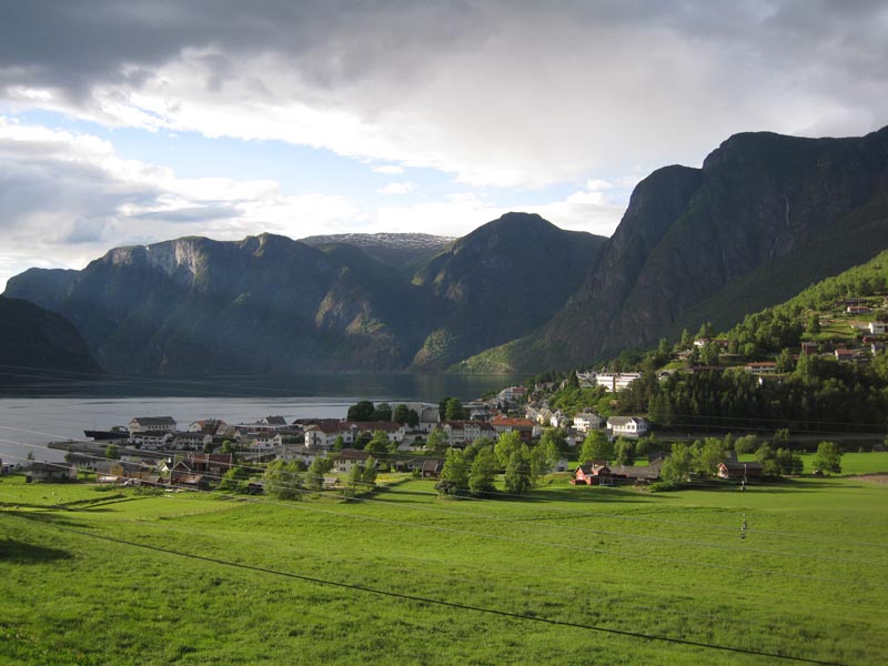
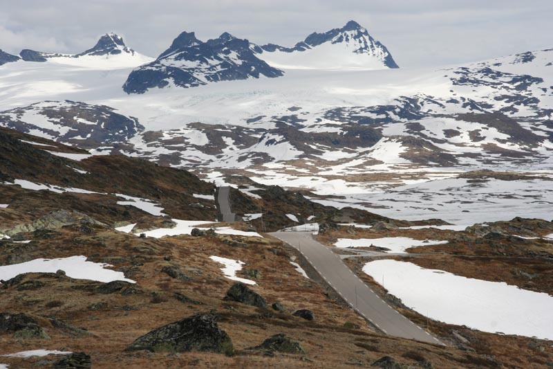
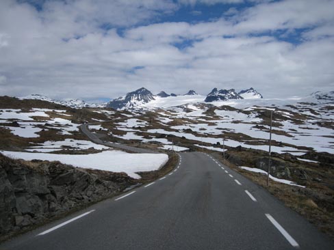
This view is one of the most significant in the whole Norway because already in the 19th century this engraving was included in a guidebook.
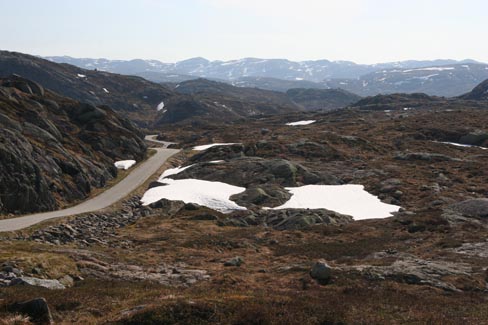
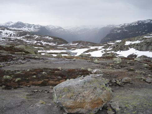
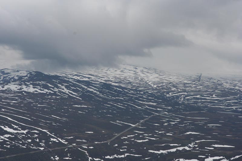
The 55th highway led us to the Jotunheim National Park. This is an alpestrine region with numerous snowy mountain peaks and the most popular mountain tourism routes in Norway.
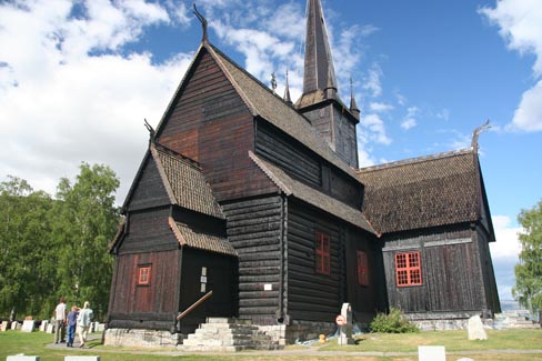
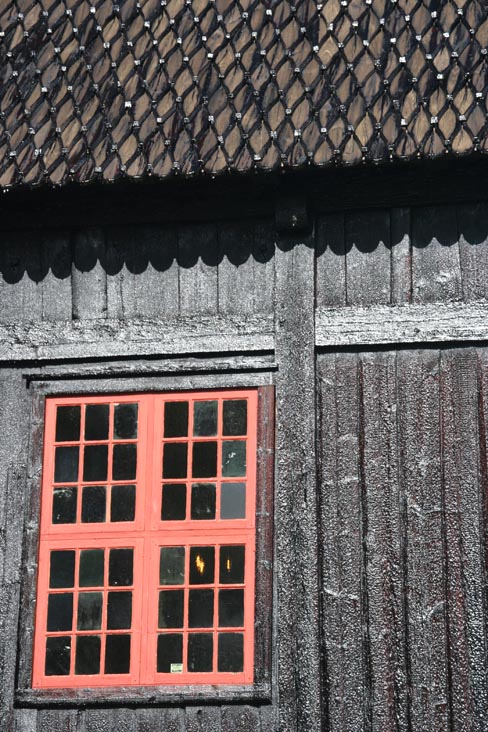
In Lom we visited the oldest wooden church, which they have covered with tar so much that we were afraid to touch it, not even mentioning going inside and praying.
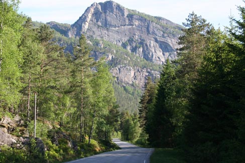
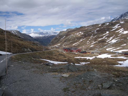
Finally in the evening we turned on the 51st highway to enjoy the beauty and majesty of Jotunheim. There was a feeling of spaciousness as in a Siberian taiga.
We found a campsite at a mighty mountain river. We cooked the Flinstones` steak. The temperature in the evening went down to almost a 0.
The morning was bleak but the forecast promised rain only later that afternoon. We must hurry.
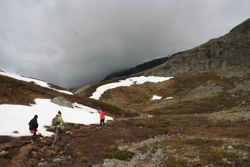
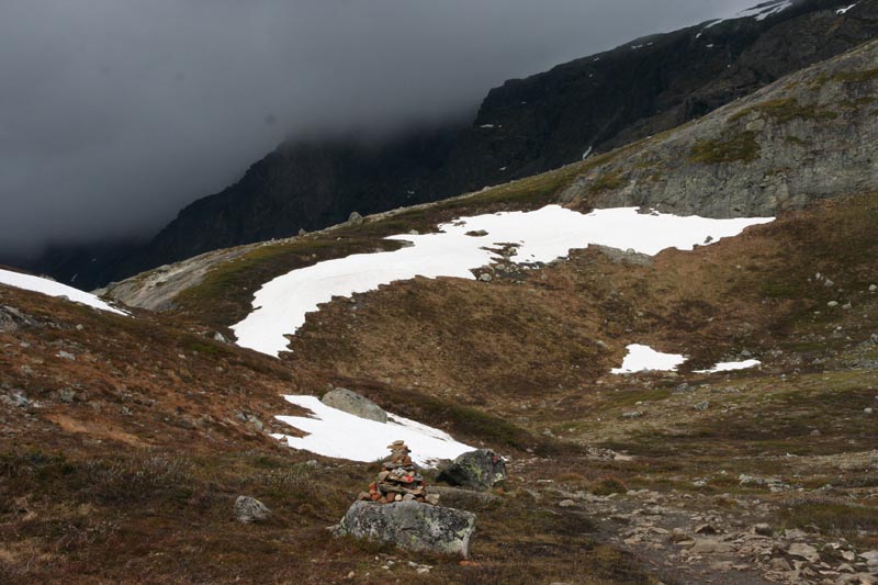
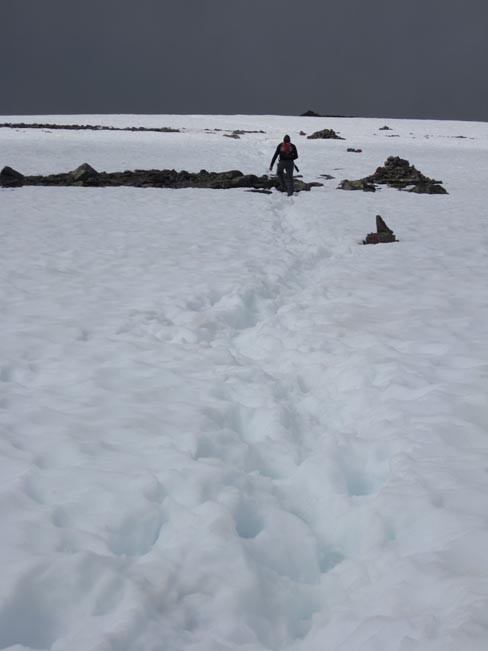
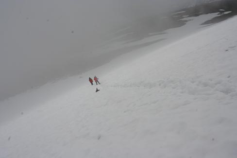
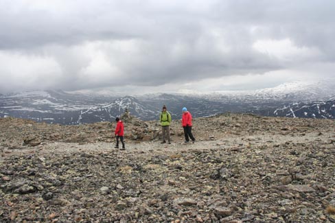
5. Besseggen pass – between two lakes of different levels (15 km, 1000 meters in height, 7-8 h)
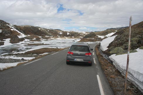
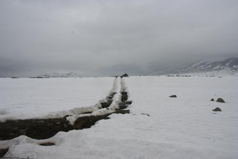
Ideally the 18km long Gjend lake is crossed by a boat and the hiking starts from the other side. We had to wait a couple of days for the opening season of the boat so we climbed up from the side of the 51st highway. No wonder the boat doesn`t ply – the other lake turned out to be still completely frozen up.
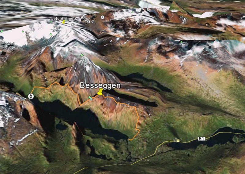
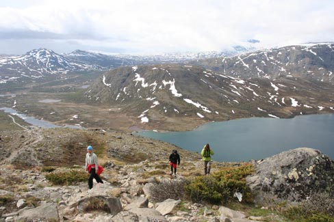
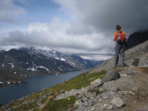
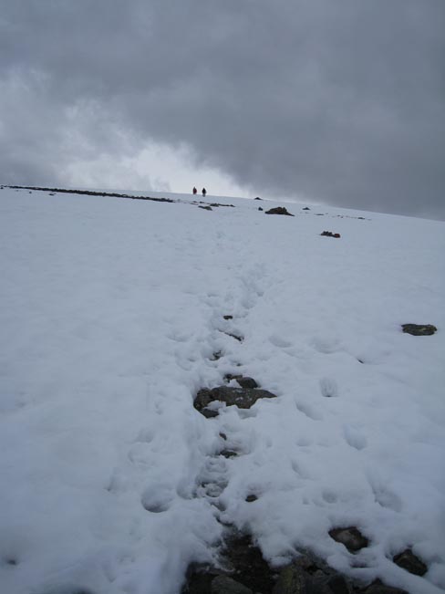
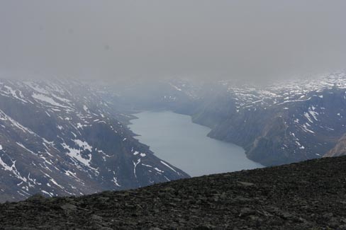
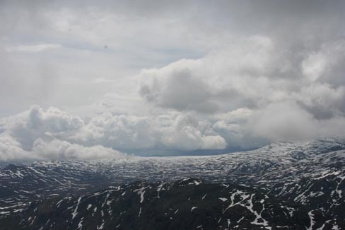
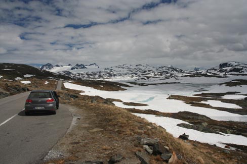
We had climbed a kilometre above the lake. The clouds slid apart and we were able to see both lakes. The higher one who was supposed to be green, turned out to be grey and completely frozen up. Then we (our cheese bred) were attacked by gulls which we had to whisk away with stones.


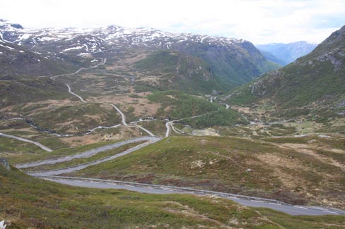
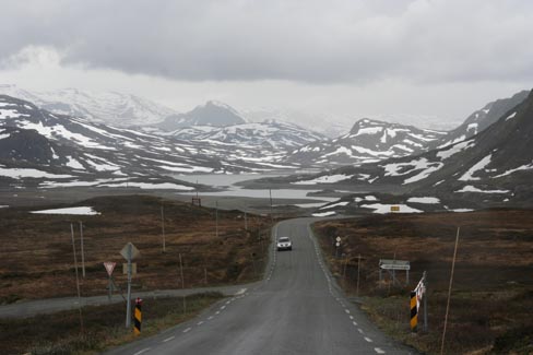
From above we could see our most distal road which seemed to have disappeared in the sky.
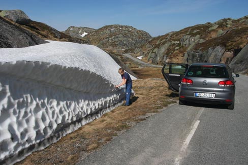
We drove over mountains of snow. Some campers had come to enjoy the pleasures of the summer too early. At least this boat was aground and was still waiting for the melting water.
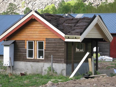
The new houses had already turf bags on their roofs.
Yesterday it rained cats and dogs. We rented a house and this time cooked … Flinstones` steak.
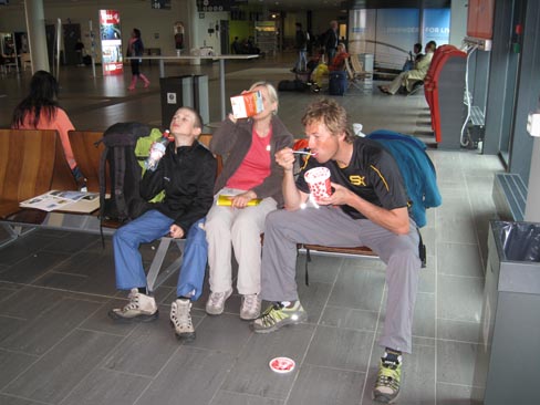
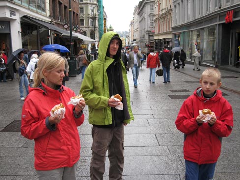
In Oslo we allowed ourselves to have lunch in a public catering place and then we got lost in the tunnels. Uncle TomTom forgot to tell us somewhere in the underground that we had to make a left turn. As a result for several km he assured that we are taking the right tunnel, even though we had long travelled completely in the wrong direction. You can imagine how confused he was when we came overground. He sent us back underground afterwards. Thank God we had time to spear until departure.
The last shot – we had to eat whole jam, which is no longer allowed on the plane because of the terrorists.